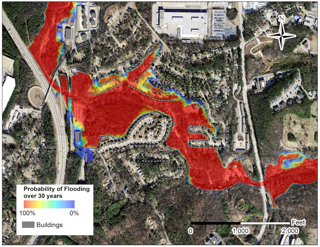
A probabilistic floodplain map for Proctor Creek in Atlanta, an urban watershed used for modeling by the researchers.
Flooding in urban areas cost Americans more than $106 billion between 1960 and 2016, damaging property, disrupting businesses and claiming lives in the process. Determining which areas are most likely to flood amid ever-changing land use and shifting rainfall and climate patterns...