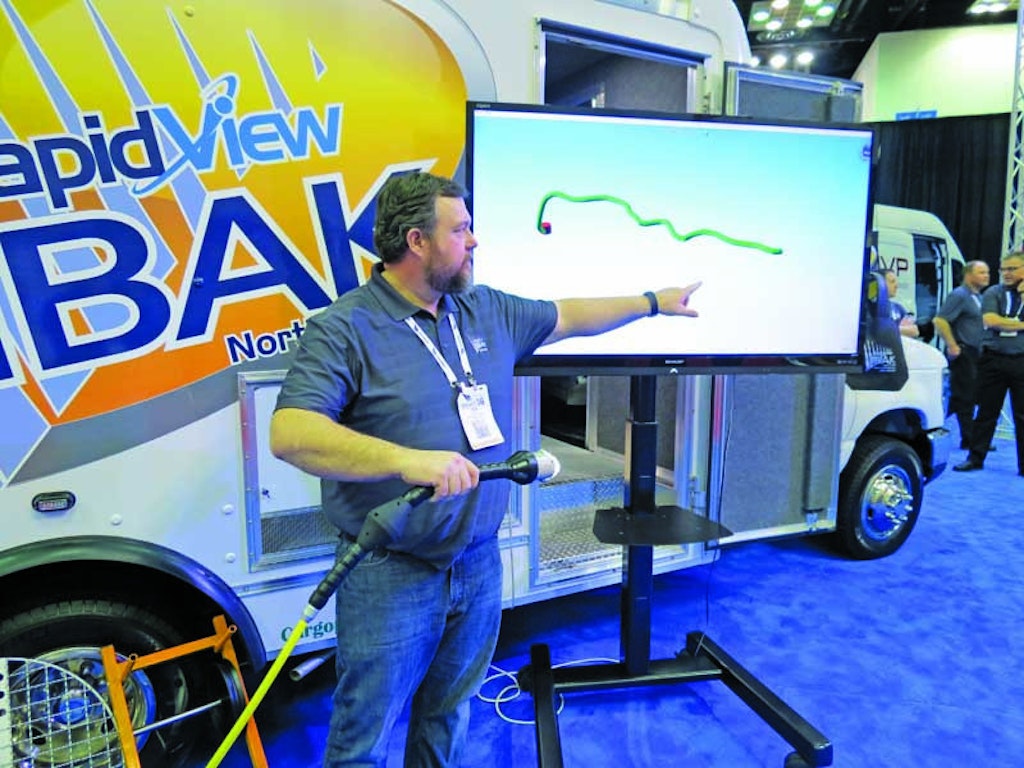
Matt Sutton, vice president of sales and marketing for RapidView IBAK North America, explains the operation of the 3-D GeoSense program to a group of attendees on the 2016 WWETT Show floor. The program allows municipalities to map lateral lines quickly and accurately in real time while performing a standard camera inspection. (Photo by Luke LeNoble)
Painting an accurate picture of all your underground assets can be both challenging and time-consuming. But a new technology on display at the Water & Wastewater Equipment, Treatment & Transport Show aims to be a real time-saver for municipalities that need to get a detailed...
Please
login or
register
to view MSW articles. It's free, fast and easy!
Comments on this site are submitted by users and are not endorsed by nor do they reflect the views or opinions of COLE Publishing, Inc. Comments are moderated before being posted.