
Order Digital Reprints
Want a PDF of this article as it appeared in print?
Order Here!
Filed Under
Sign Me Up!
Join your colleagues who already get great content delivered right to their inbox.
Sign up Digital!
If you don't want to bring your iPad into the bathroom, we can send you a magazine subscription for free!
Subscribe to Print!
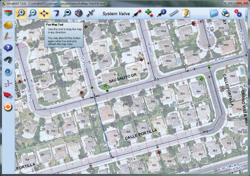
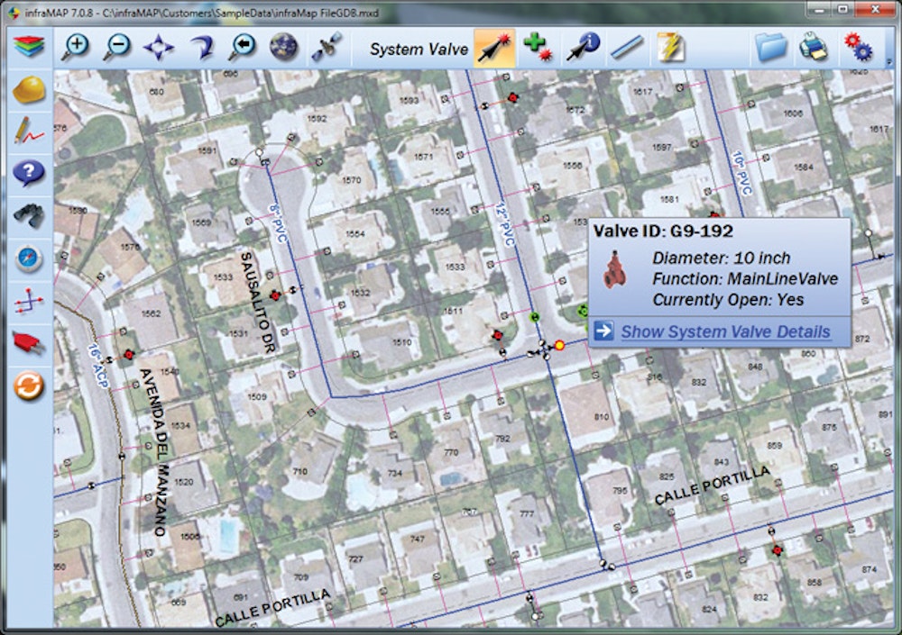
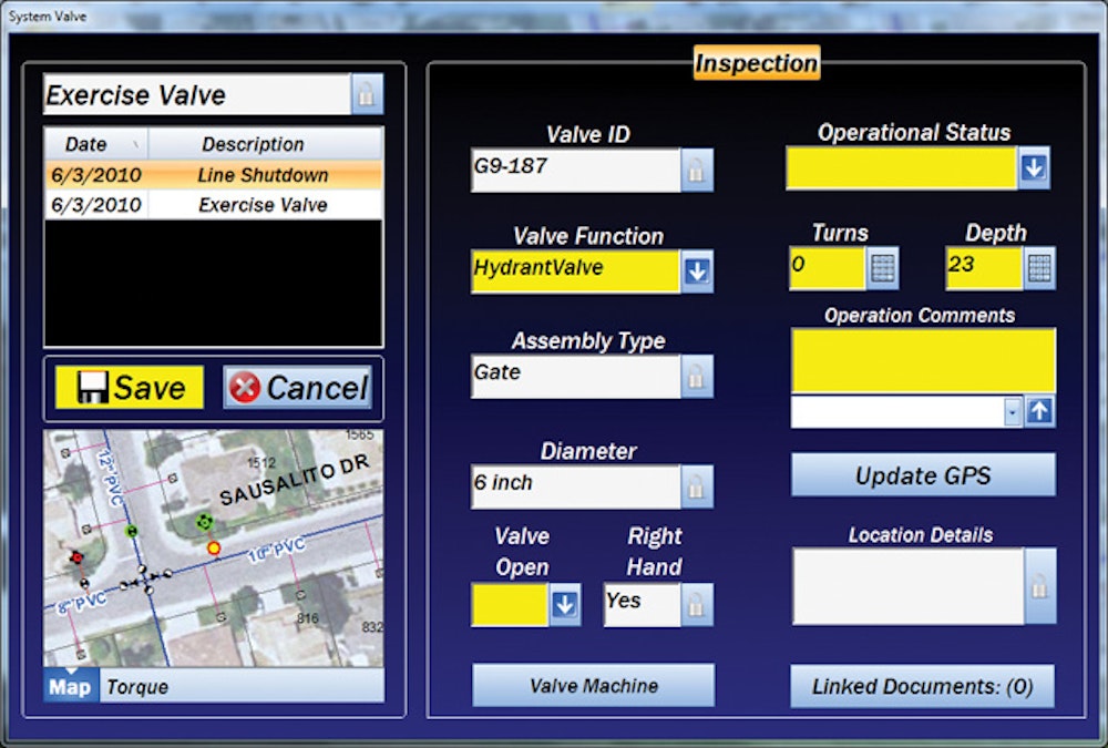
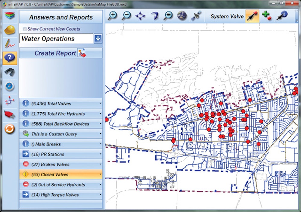
Infrastructure software is a powerful tool for municipal managers and engineers, but what about field crews? Software tools can make their work easier, too.
That’s the idea behind infraMAP software from iWater, Inc. The company describes the application as “by field crews, for...